
Where Is the Everest Mountain Located? Map & Height

Activities Highlights
Key takeaways
- Mount Everest sits on the border between Nepal and the Tibet Autonomous Region of China, with its summit line splitting the two countries.
- The summit stands at 8,848.86 meters (29,031.7 feet), the figure Nepal and China jointly announced in December 2020.
- On the Nepal side, Everest lies in Solukhumbu District inside Sagarmatha National Park, a UNESCO World Heritage Site.
- The peak belongs to the Mahalangur Himal, a range that holds four of the six highest mountains on Earth.
- The Nepal side gives you Kala Patthar for the classic summit view; the Tibet side gives you Rongbuk, where you can drive close to the north face.
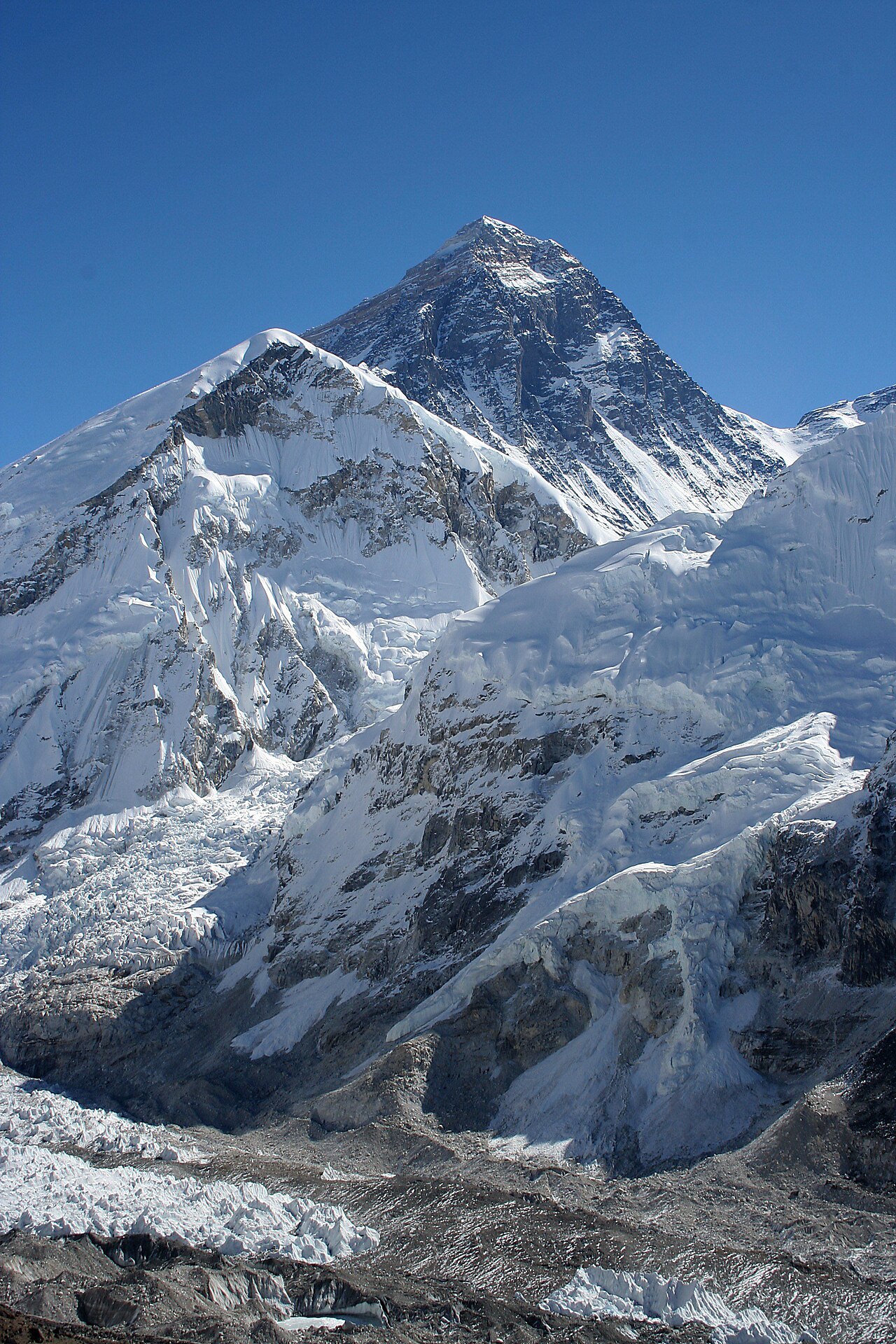
Mount Everest sits on the border between Nepal and the Tibet Autonomous Region of China, in a section of the Himalaya called the Mahalangur Himal. Its summit reaches 8,848.86 meters, and the international boundary runs directly across that summit, so the highest point on Earth belongs to two countries at the same time.
That single fact surprises a lot of people. Everest is not tucked inside one nation with a clean address. It straddles a line. If you stood on the true top, one boot could rest in Nepal and the other in China. This guide answers where the Everest mountain is located in plain terms: the country, the range, the coordinates, the neighboring giants, and the places on both sides where you can actually stand and look at it.
Everest's Exact Location in the Himalayas
The Himalaya stretch roughly 2,400 kilometers across five countries, from Pakistan in the west to the eastern edge of India, Nepal, Bhutan and Tibet. Everest sits toward the eastern-central part of that arc, in the Nepal-Tibet section, not the far west near K2 and not the far east near Bhutan.
On the Nepal side, the mountain rises inside Solukhumbu District, in the country's northeast. The whole area around the peak falls within Sagarmatha National Park, the protected zone that gives the Everest region its trails, its Sherpa villages, and its ranger checkpoints. On the Tibet side, the mountain sits in Tingri County, within the Qomolangma National Nature Reserve.
Kathmandu, Nepal's capital and the arrival point for most travelers, lies roughly 150 to 170 kilometers from the summit in a straight line. That sounds close, but there is no road to the base of the mountain. The Himalaya between Kathmandu and Everest fold into ridges and river gorges that a straight-line distance hides completely. Most trekkers fly into the mountain airstrip at Lukla and then walk for days to close that gap.
The Nepal-China (Tibet) Border Explained
The boundary that crosses Everest's summit is a real, surveyed international border, agreed between Nepal and China. It follows the high watershed of the range, the natural crest where the mountains divide the rivers flowing south into Nepal from those flowing north into Tibet. Everest happens to sit on that crest, which is why the line runs straight over the top.
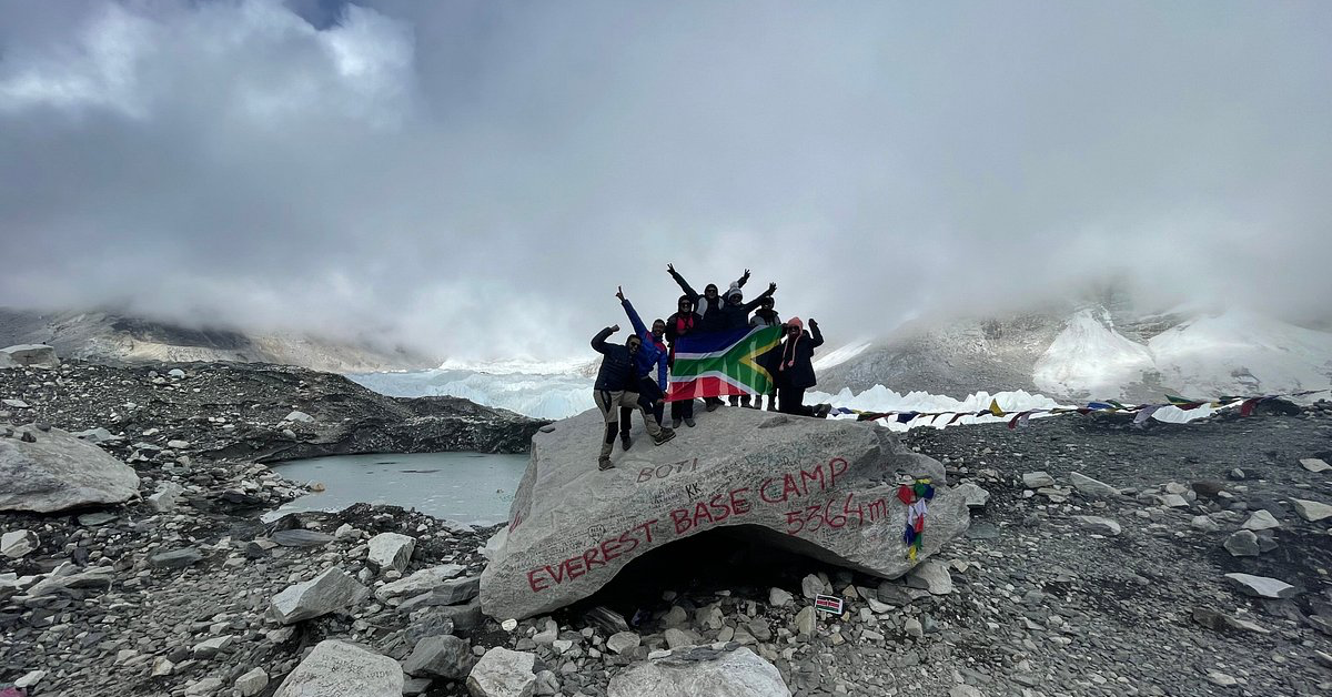
This border shapes how you visit. From Nepal, you approach the mountain's south side and reach the Nepal Everest Base Camp at about 5,364 meters. From Tibet, you approach the north side and reach a separate base camp near Rongbuk Monastery. The two base camps are on opposite flanks of the same mountain, separated by the summit ridge and by a national frontier. You cannot walk from one to the other as a trekker. Each side needs its own permits, its own entry point, and its own itinerary.
Nepal opened its side to foreign climbers and trekkers in the 1950s, and the southern approach became the classic route. The Tibet side runs through Chinese permit systems and is usually reached overland from Lhasa or across the friendship border. If you want the Tibet experience, a guided Tibet group tour handles the permits and the high-altitude driving, which is not something an independent traveler can arrange casually.
Elevation, Coordinates and Neighboring Peaks
Everest stands at 8,848.86 meters, which is 29,031.7 feet. Nepal and China announced this jointly on 8 December 2020, after separate surveys from each country were reconciled into a single agreed figure, as reported by NPR. Before that, the commonly cited height was 8,848 meters, an Indian survey number from the 1950s. The 2020 figure is now the standard you will see on official maps.
The summit sits at approximately 27.988 degrees north and 86.925 degrees east. In older map notation that reads as 27 degrees 59 minutes north, 86 degrees 55 minutes east. Those coordinates place it firmly in the eastern Nepal-Tibet borderlands.
Everest does not stand alone. It is surrounded by some of the tallest mountains on the planet:
- Lhotse (8,516 meters), the fourth-highest mountain on Earth, connected to Everest by the South Col and sharing the same approach valley on the Nepal side.
- Makalu (8,485 meters), the fifth-highest, about 19 kilometers to the southeast.
- Cho Oyu (8,188 meters), the sixth-highest, to the west near the Nangpa La pass that Sherpa traders once used to cross into Tibet.
- Nuptse (7,861 meters), a wall of a peak that actually blocks the view of Everest's summit from the Nepal Base Camp, which is why trekkers climb a separate hill for the real view.
The scale of these numbers is worth pausing on. Everest's summit sits well inside what climbers call the death zone, the altitude above roughly 8,000 meters where the air holds only about a third of the oxygen available at sea level and the human body slowly deteriorates. Four of the peaks around Everest cross that 8,000-meter line, which is why this small patch of the border region draws serious mountaineers from around the world. For trekkers, the reassuring counterpoint is that the standard walking routes stop far below that zone: the Nepal Base Camp at 5,364 meters is high and demanding, but it is nowhere near the summit's extremes.
How the Mahalangur Range Shapes the Region
Everest belongs to the Mahalangur Himal, a sub-range of the Himalaya rather than the whole mountain chain. Naming the range matters, because the Mahalangur is unusually dense with giants. It contains four of the six highest mountains on Earth: Everest, Lhotse, Makalu and Cho Oyu. No other stretch of the planet packs that much altitude into one range.
Geologists trace all of this to the collision between the Indian and Eurasian tectonic plates, which began tens of millions of years ago and is still lifting the range today. That slow upward push is why Everest is not a fixed number in stone: the mountain is still rising and shifting by small amounts each year, and earthquakes can nudge the figures, which is part of why the 2020 resurvey mattered.
The Mahalangur splits into smaller sections, and the one most travelers actually enter is the Khumbu. The Khumbu holds Everest, Lhotse, Nuptse and the icefall that climbers cross above Base Camp. It is also the homeland of the Sherpa people, whose villages, monasteries and mountaineering knowledge define the trekking experience on the Nepal side. When you hear "the Khumbu," that is the working name for the Everest region on the ground, even though the broader range is the Mahalangur.
Where Everest Sits Relative to Nepal's Other Trekking Regions
It helps to place Everest against the rest of the country, because Nepal's famous trekking areas sit in different corners and the geography decides your travel logistics.
Everest and its Khumbu region sit in the northeast. To reach it, most travelers fly east from Kathmandu to Lukla, then walk north toward the border. The Annapurna region, by contrast, lies to the west of Kathmandu, reached through the city of Pokhara, and offers a completely separate cluster of peaks and trails. Between the two, closer to Kathmandu, sits the Langtang region, and further west again lies the remote Manaslu circuit. Each of these is a distinct Himal, a distinct set of valleys, and a distinct permit zone.
For a first-time visitor, the practical takeaway is that "trekking in Nepal" is not one place. Choosing Everest specifically commits you to the northeast, to the Lukla flight, and to the higher average altitudes of the Khumbu. It is worth knowing that the Everest region generally runs colder and higher than Annapurna's lower foothill treks, which is one reason acclimatization planning matters more here than on gentler routes elsewhere in the country.
Sacred Names on Both Sides of the Border
The mountain carries different names in the two cultures that share it, and each name tells you something about how it is seen. In Nepal, it is Sagarmatha, a Nepali name meaning roughly "Peak of Heaven," coined in the twentieth century and officially adopted in 1956. In Tibet, it is Chomolungma, or Qomolangma, which is usually translated as "Goddess Mother of the World." The Tibetan name is far older and appeared on a European atlas as early as 1733, long before the mountain was measured by British surveyors.
The English name Everest came later, from a nineteenth-century survey that honored a British surveyor general. For travelers, the local names are worth knowing because you will see them everywhere: the Nepali national park is Sagarmatha National Park, and Tibetan signage and monasteries use Chomolungma. Using the local names is also a small mark of respect in a region where the mountain is genuinely sacred, not just a climbing objective.
Sagarmatha National Park: The Protected Heart of the Nepal Side
On the Nepal side, almost everything a trekker sees falls inside Sagarmatha National Park. UNESCO inscribed the park as a World Heritage Site in 1979, recognizing both its extreme landscape and its living Sherpa culture, according to the UNESCO World Heritage Centre. It was Nepal's first natural World Heritage Site.
The park covers a high, glaciated world of deep valleys, alpine forests lower down, and bare rock and ice above. It protects wildlife such as the snow leopard and the Himalayan tahr, along with the Gokyo Lakes, a chain of high-altitude lakes that also carry international wetland protection. For a visitor, the practical meaning is simple: you pay a park entry fee, you follow marked trails, and you pass through checkpoints that track who is on the mountain. Those systems exist to keep both the environment and the trekkers safer, and they are part of why responsible operators emphasize leaving the trails as clean as you found them.
Viewing Points From the Nepal Side
You do not have to climb Everest to look it in the face. The Nepal side has several viewpoints that put the summit in clear view, each at a different level of effort.
Kala Patthar (about 5,545 meters) is the classic. Its name means "Black Rock" in Nepali, and it is a dark hill above the village of Gorak Shep. It matters because Everest's summit is hidden behind Nuptse from the Nepal Base Camp itself, so trekkers climb Kala Patthar at dawn to see the top of the world glow at sunrise. This is the postcard view most people picture.
Everest Base Camp (about 5,364 meters) is the destination of the famous trek. You will not see the summit from the camp, but you stand at the foot of the Khumbu Icefall, at the launching point for every Nepal-side ascent. The achievement is being there, in the amphitheater of ice, rather than the summit view.
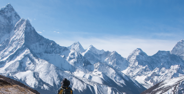
Gokyo Ri and Tengboche offer alternatives. Gokyo Ri, above the Gokyo Lakes, gives a wide panorama that includes Everest along with Lhotse, Makalu and Cho Oyu in one sweep. Tengboche, lower down at its famous monastery, frames Everest behind the spire of Ama Dablam and needs far less altitude to reach.
If you are weighing when to attempt any of these, remember that the mountain views depend heavily on the season, with the clearest skies falling in spring and autumn and the most haze and snow in the months between.
Viewing Points From the Tibet Side
The Tibet side gives a very different experience, and for some travelers a more accessible one. From the north, a road runs surprisingly close to the mountain, so you can reach a viewpoint near the base without the multi-day walk that Nepal demands.
Rongbuk Monastery (about 5,000 meters) is the anchor. Often described as the highest monastery in the world, it sits directly below Everest's north face and frames the mountain in a way the Nepal side cannot match. Because the road reaches it, travelers who cannot manage a long high-altitude trek can still stand within sight of the summit.
The Tibet Base Camp (around 5,150 to 5,200 meters) lies a short distance beyond Rongbuk. This is the historic side of the mountain, the face that early British expeditions attempted in the 1920s, and the view of the sheer north wall is unobstructed. The trade-off is that reaching it means driving to very high altitude quickly, which brings its own acclimatization risks, so a properly paced itinerary matters even when there is a road.
Because Tibet requires Chinese travel permits arranged in advance, the north side is almost always visited as an organized tour rather than independently. Mission Nepal Holidays runs guided Tibet journeys, including overland routes from Kathmandu to Lhasa, that build in the permits and the altitude pacing this side needs.
What the Border Location Means for Permits and Access
Everest's split location has a direct, practical consequence: the paperwork and the way in differ completely depending on which side you choose, and confusing the two is a common planning mistake.
On the Nepal side, a trek to Base Camp typically requires a Sagarmatha National Park entry permit plus a local Khumbu area permit, arranged in Nepal. You also need a Nepal tourist visa, which most nationalities can get on arrival in Kathmandu or in advance. There is no separate climbing permit for trekking to Base Camp; the expensive summit permits apply only to those actually attempting the mountain. Access is by the Lukla flight followed by walking, with no road shortcut to the trailheads deep in the Khumbu.
On the Tibet side, you enter through China, which means a Chinese visa plus a Tibet Travel Permit, and independent travel is generally not allowed. Foreign visitors to the Tibet Autonomous Region must travel with a registered guide and a pre-arranged itinerary, so the north side is effectively tour-only. The upside is road access close to the mountain; the constraint is that you cannot simply show up and arrange it locally the way you can piece together a Nepal trek.
Because these two systems do not overlap, you commit early. Deciding "Everest from Nepal" or "Everest from Tibet" is really a decision about visas, permits, transport and pacing, all set in motion by that line running across the summit.
Trips That Bring You Face to Face With Everest
Knowing where Everest is located naturally raises the next question: which trip actually gets you there. The answer depends on how much time you have, how you handle altitude, and whether you want to walk to the mountain or ride most of the way.
- Everest Base Camp Trek (Nepal side). The signature journey. You fly to Lukla, then walk for roughly ten to fourteen days round trip through Sherpa villages to Base Camp and Kala Patthar. It asks for patience and steady acclimatization more than raw athletic ability, and it remains the definitive way to reach the mountain on foot.
- Everest Base Camp Heli Trek. A shorter option that walks part of the classic route and uses a helicopter to save days or to avoid the hardest sections. It suits travelers with limited time or those who want the high viewpoints without the full trek.
- Everest three high passes and Gokyo variations. Harder loops for experienced trekkers who want more than the standard route, linking high passes and the Gokyo Lakes for wider panoramas of the Mahalangur peaks.
- Tibet Everest tours (north side). Overland or fly-in trips from Lhasa or Kathmandu that reach Rongbuk and the north Base Camp by road, best for travelers who want the summit view with far less walking.
If you are still deciding among Nepal's guided options, it helps to compare how the Everest routes stack up against Annapurna and other regions, so you can match a trip to your fitness and your calendar rather than picking the most famous name by default.
Final Thoughts
Everest's location is more than a map pin. It is a shared summit on a national border, the high point of the Mahalangur Himal, and a sacred mountain with two names and two very different ways in. Understanding that geography is the first real step in planning a trip, because it decides which side you visit, which permits you need, and which viewpoint will put you face to face with the top of the world.
The practical next move is to pick your side and your effort level: the Nepal trek for the walk-in experience and Kala Patthar sunrise, or the Tibet route for the drive-up north face at Rongbuk. When you are ready to turn the map into an itinerary, the team at Mission Nepal Holidays can match you to the right Everest route and handle the permits, guides and pacing for whichever side of the mountain you choose.
Frequently asked questions
What country is Mount Everest in?
Both. The summit sits directly on the border between Nepal and the Tibet Autonomous Region of China, so the mountain belongs to two countries at once.
How tall is Mount Everest?
8,848.86 meters, or 29,031.7 feet. Nepal and China jointly announced this revised official height in December 2020.
What are the coordinates of Mount Everest?
Roughly 27.988 degrees north, 86.925 degrees east, in the Mahalangur Himal section of the Himalayas.
Can you see Everest from both Nepal and Tibet?
Yes. On the Nepal side the best summit view is from Kala Patthar; on the Tibet side you can drive close to the north face at Rongbuk.
Is Everest in the Himalayas?
Yes. Everest belongs to the Mahalangur Himal, a sub-range within the greater Himalaya that also holds Lhotse, Makalu and Cho Oyu.