 Sep - Nov & Mar - May
  Car, Flight
  Moderate
  6,470m
  17 Days
 Climbing
 Trip Overview
Mera Peak Climbing
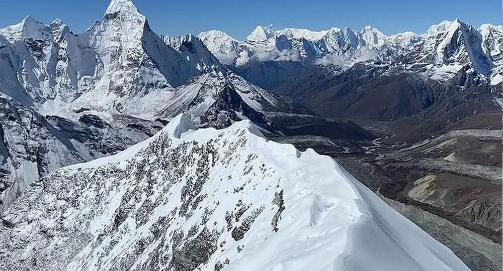
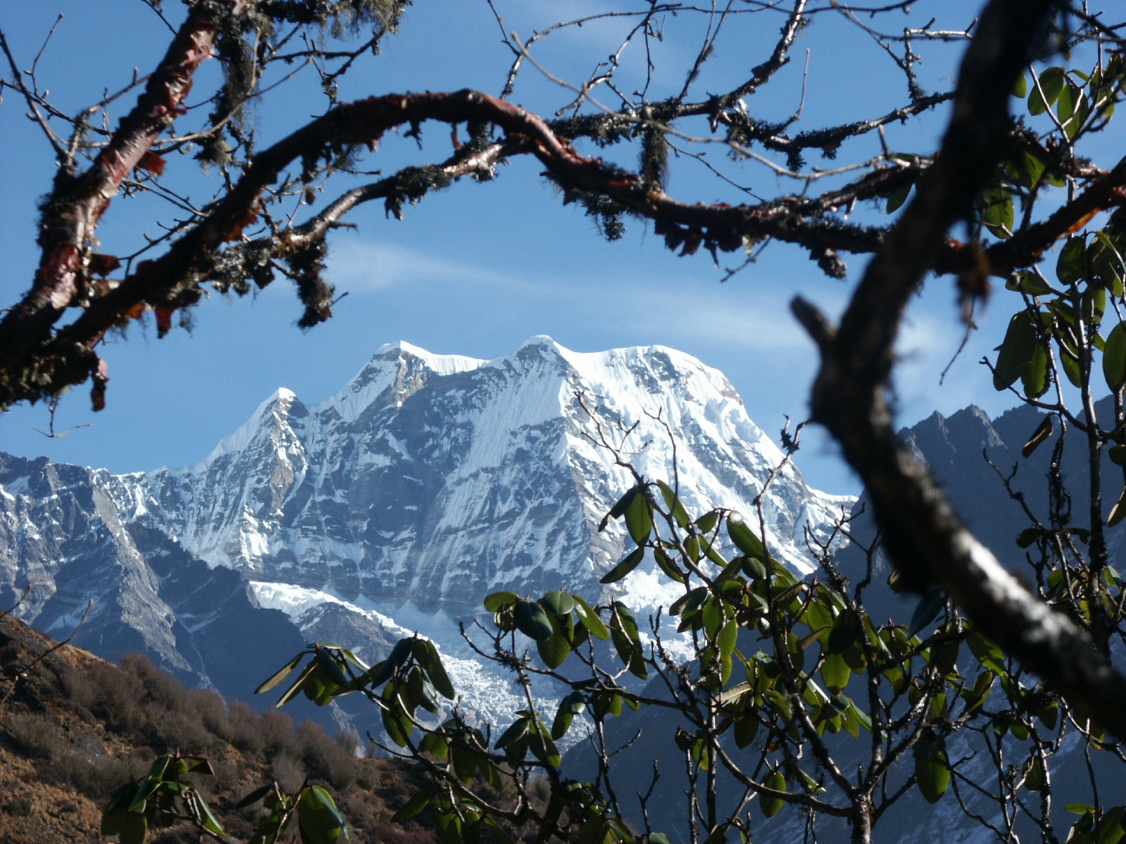
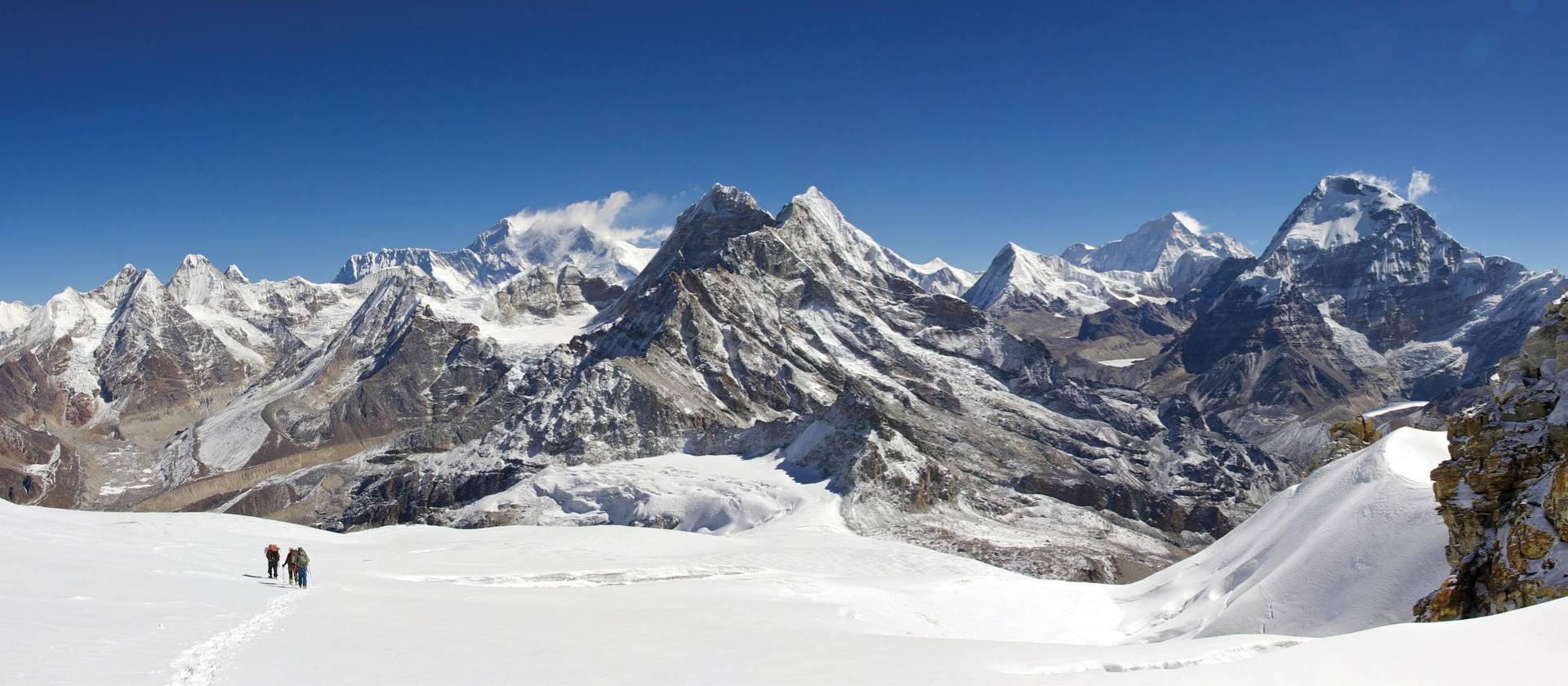
Mera Peak Climbing (6,476m) is one of the most popular and thrilling trekking peaks in Nepal, ideal for both beginners and experienced climbers seeking a Himalayan mountaineering challenge. Located on the edge of the Khumbu region, Mera Peak is the highest trekking peak in Nepal permitted for climbing, offering an unforgettable adventure and breathtaking views of the five highest mountains in the world — Mt. Everest (8,848m), Kanchenjunga (8,586m), Lhotse (8,516m), Makalu (8,463m), and Cho Oyu (8,210m).
Highlights of Mera Peak Climbing
-
Stunning panoramic views of five 8,000-meter peaks.
-
Adventurous flight to Lukla and scenic trekking through Sherpa villages.
-
Rich Himalayan culture, traditional Sherpa lifestyle, and diverse landscapes.
-
A non-technical climb suitable for enthusiastic trekkers with basic training.
-
Expert guides and flexible itineraries for safe, enjoyable ascent.
About Mera Peak
Mera Peak lies in the Mahalangur Range of the Himalayas. The central summit of Mera was first climbed in 1953 by British Army officer Jim Roberts, known as the grandfather of trekking in Nepal, along with Tenzing Norgay Sherpa. Later, Mera North was ascended in 1975 by French climbers Marchel Jolley, G. Baus, and L. Honis.
This iconic peak offers a true Himalayan experience — from lush forests and remote valleys to spectacular glaciers and high-altitude climbing.
Mera Peak Climbing Route
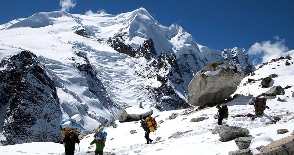
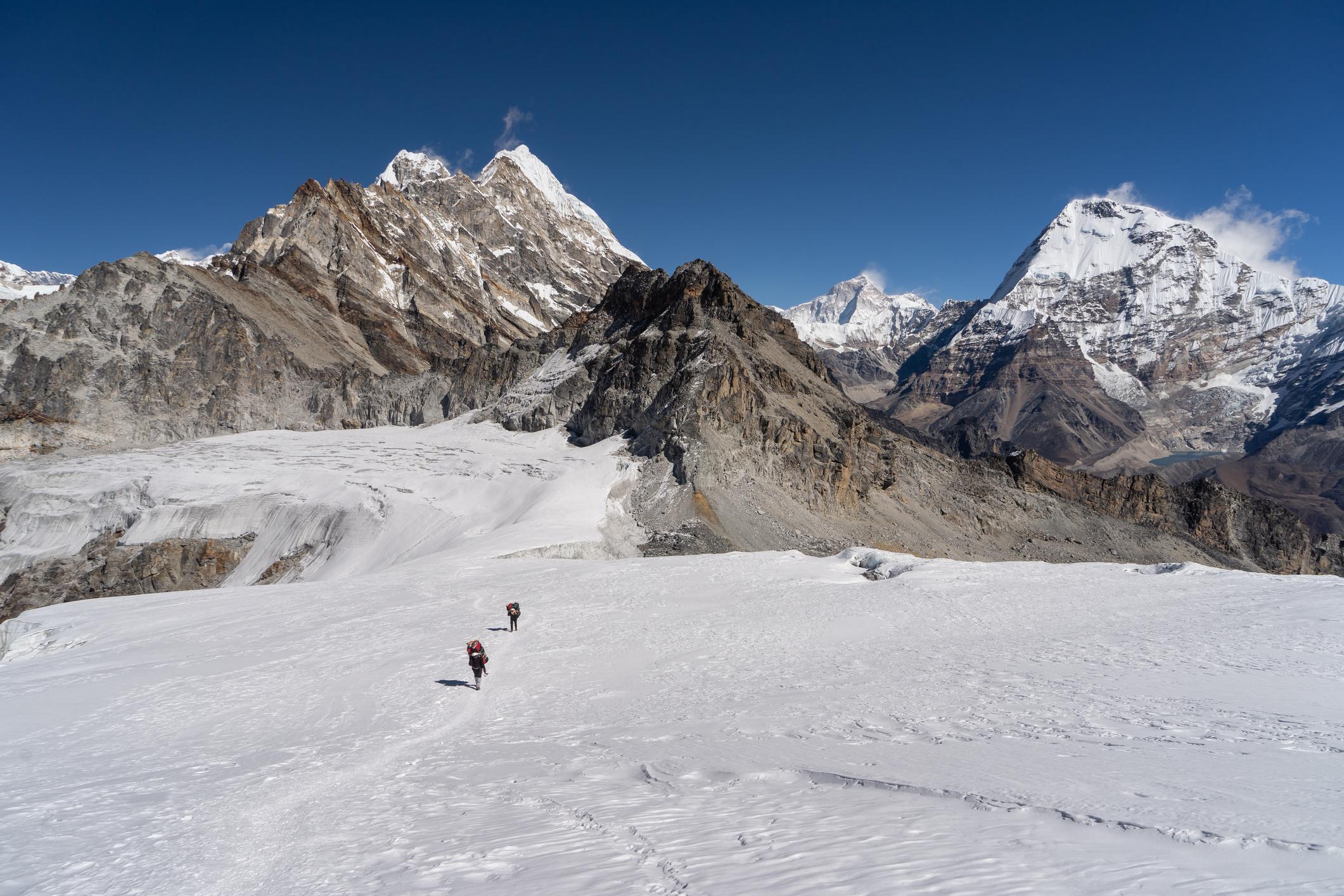
There are three possible routes to climb Mera Peak, but we follow the most popular and rewarding route via Chutanga – Chatra La – Kothe – Thagnak – Khare – Mera Base Camp – High Camp – Summit. This itinerary ensures steady acclimatization while providing opportunities to explore the stunning Hinku Valley, one of Nepal’s most beautiful and untouched alpine regions.
Along the way, trekkers will encounter:
-
Picturesque Sherpa villages and ancient monasteries.
-
Dense rhododendron and pine forests.
-
Suspension bridges, glacial streams, and yak pastures.
-
Towering snow-capped peaks surrounding the valley.
Journey Overview
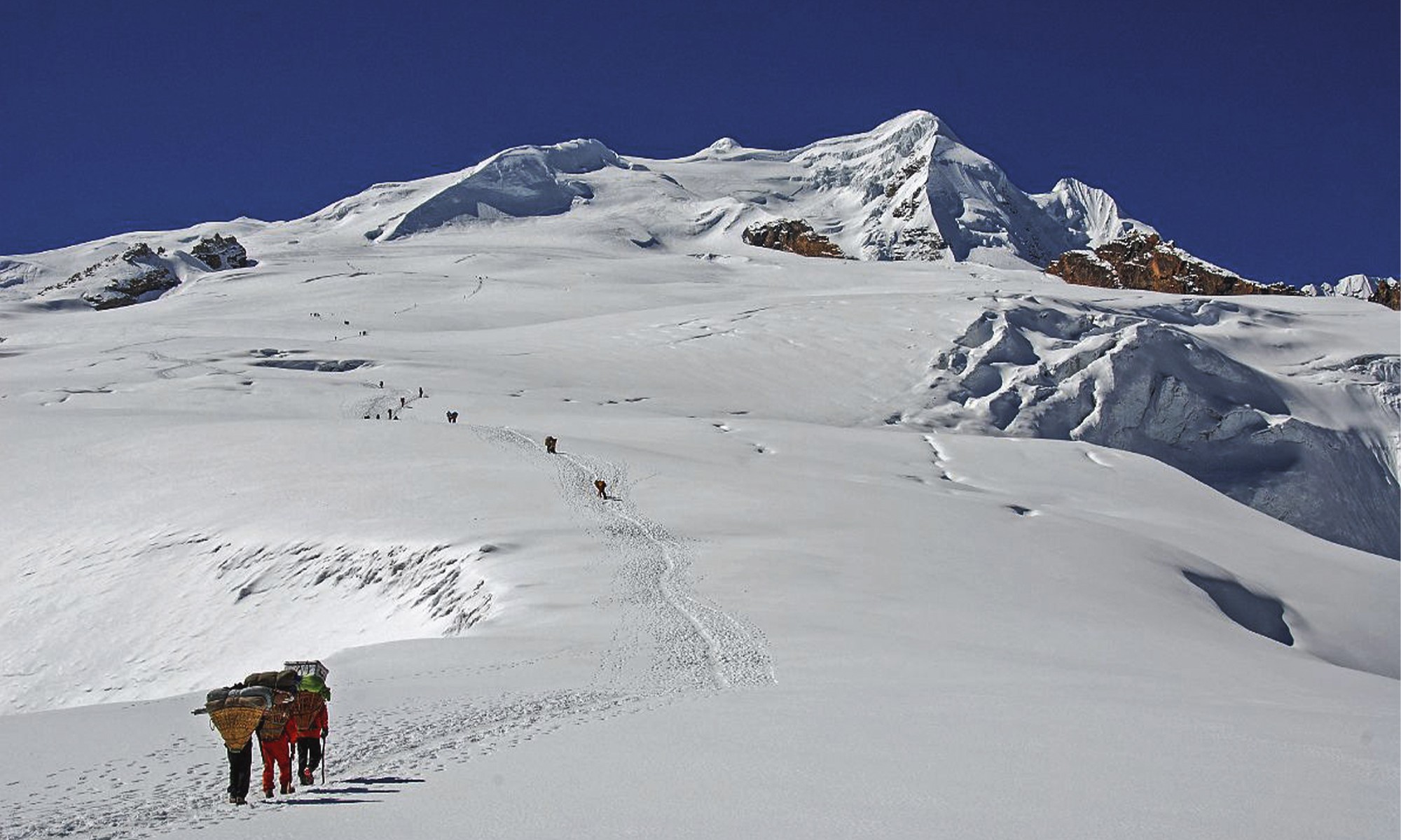
Your Mera Peak Expedition begins with an exciting mountain flight from Kathmandu to Lukla, one of the world’s most thrilling airstrips. From there, the trek winds through pristine forests, glacier moraines, and Sherpa settlements before reaching Khare (5,000m) — the base for your climb.
While the climb to Mera Peak Summit (6,476m) is physically demanding, it is considered non-technical, making it achievable for fit trekkers. Our professional climbing guides will provide basic mountaineering training and ensure the use of essential gear such as ice axes, crampons, harnesses, and ropes.
Best Time for Mera Peak Climbing
The best seasons for Mera Peak climbing are spring (April–May) and autumn (late September–October). During these months, the weather is stable, skies are clear, and temperatures are ideal for high-altitude trekking and climbing.
Difficulty Level and Preparation
Mera Peak Climbing is graded as Physically Strenuous (PS). Though the climb involves glacier travel and high altitude, it is not highly technical. Prior trekking experience is helpful but not mandatory. Our expert guides provide pre-climb orientation and basic mountaineering training at Khare.
Why Choose Us for Your Mera Peak Expedition?
-
Experienced and licensed mountain guides
-
Safety-first approach with quality climbing gear
-
Tailor-made and flexible itineraries
-
Guaranteed departure dates and group discounts
-
Authentic local experience with Sherpa hospitality