
Annapurna Circuit in Nepal: Full Trek Itinerary

Activities Highlights
Key takeaways
- The Annapurna Circuit crosses Thorong La at 5,416 meters, the highest point of the trek and the day that demands the most patience.
- Plan 12 to 18 days on the trail so your body has time to acclimatize; the CDC advises gaining no more than 500 meters of sleeping altitude per night above 3,000 meters.
- October to November and March to May give the most stable weather and clearest mountain views.
- You need an ACAP entry permit for the Annapurna Conservation Area, plus a TIMS card where required; costs and rules shift, so confirm when you book.
- Road construction has shortened the classic route, and many trekkers now start higher up the valley by jeep to focus their days on the best walking.
The Annapurna Circuit in Nepal takes most trekkers 12 to 18 days on the trail, loops around the Annapurna massif, and peaks when you cross Thorong La pass at 5,416 meters. If you are reading this while comparing operators and dates, the two questions on your mind are usually the same: how hard is it, and how do the days actually break down.
This guide answers both. Below you will find a day-by-day route overview, a realistic look at crossing Thorong La safely, the villages and landscapes that give the circuit its reputation, an honest read on difficulty and acclimatization, and the permits, costs and seasons you need to plan around. The trek rewards patience more than raw fitness, and the itinerary is built to give your body the time it needs.
What the Annapurna Circuit Actually Is
The circuit is a horseshoe-shaped route that climbs the Marsyangdi river valley on its eastern side, crosses the Thorong La pass, and descends the Kali Gandaki gorge on the west. Along the way you pass through subtropical foothills, alpine meadows, and a high, arid landscape that looks and feels closer to Tibet than to lowland Nepal.
The full walking distance has historically run to roughly 160 to 230 kilometers, depending on where you start and finish, according to the route overview compiled on Wikipedia's Annapurna Circuit entry. Road construction up both valleys has changed that math. Many trekkers now take a jeep past the lower, dusty road sections and start walking higher up, which trims several days and keeps the focus on the best terrain. The trade-off is honest to weigh: you lose some quiet lower villages but gain more time in the alpine high country most people come for.
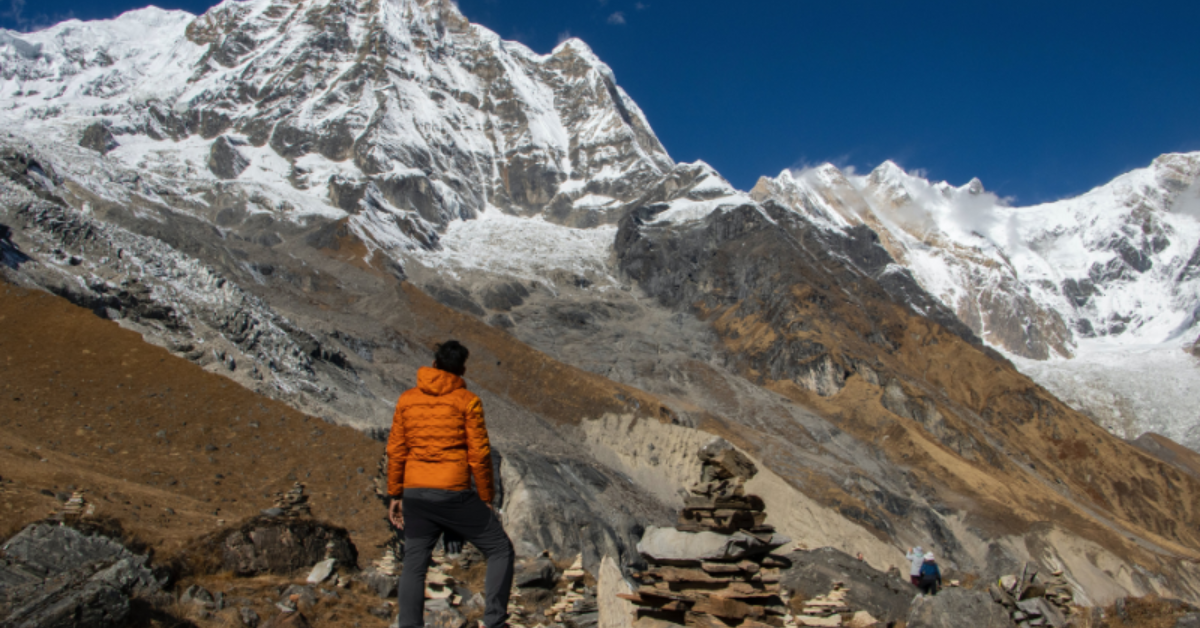
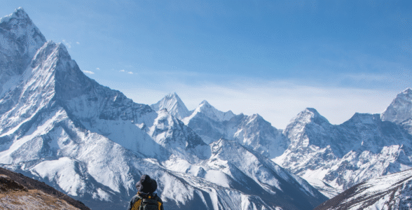
The scenery is the draw. Annapurna I, the tenth-highest mountain on earth at 8,091 meters, anchors the range, and you trek in the shadow of a dozen peaks over 6,000 and 7,000 meters.
Day-by-Day Annapurna Circuit Route Overview
Itineraries vary by operator and by how much road transport you use, so treat this as a representative 14-day plan built around safe acclimatization. Exact stages shift with weather and group pace, so confirm the specifics when you book.
- Day 1: Kathmandu to Besisahar to Chame (drive). A long road day by private jeep brings you to Chame, around 2,670 meters, skipping the dustiest lower sections.
- Day 2: Chame to Upper Pisang. The valley narrows and the forest thickens. First clear views of the Annapurna range open up near Pisang, roughly 3,300 meters.
- Day 3: Upper Pisang to Manang. Take the high route through Ghyaru and Ngawal for the finest views and better acclimatization. You reach Manang at about 3,540 meters.
- Day 4: Manang acclimatization day. A rest day with a short climb to a viewpoint or the Gangapurna glacier lake. You sleep at the same altitude to let your body adjust.
- Day 5: Manang to Yak Kharka. A shorter, deliberate climb to around 4,050 meters. The vegetation thins to scrub and grazing land.
- Day 6: Yak Kharka to Thorong Phedi. A modest gain to about 4,540 meters at the base of the pass. Many trekkers push to High Camp, near 4,880 meters, to shorten the summit day.
- Day 7: Thorong Phedi to Muktinath via Thorong La. The big day. You start before dawn, cross the pass at 5,416 meters, and descend to Muktinath at roughly 3,800 meters.
- Day 8: Muktinath to Jomsom. A descent through the dramatic Kali Gandaki gorge, with the option to visit the sacred temple complex before leaving.
- Days 9 onward: Fly or drive out from Jomsom to Pokhara, or extend with side trips. Many trekkers close the loop at Pokhara.
Adding the Tilicho Lake side trip, one of the highest lakes of its size at 4,919 meters, extends the itinerary by two to three days and is worth building in if your schedule allows.
Crossing the Thorong La Pass Safely
Thorong La at 5,416 meters is the physical and emotional high point of the trek, and the day that catches out the unprepared. The crossing itself is a long, steady walk on a good trail. There is no technical climbing and no ropes. What makes it hard is the altitude, the cold, and the length: six to nine hours of walking that starts in the dark.
A few things keep the pass safe rather than dangerous:
- Start early. Most groups leave between 4 and 5 a.m. so they clear the pass before the afternoon wind picks up. Wind on the top can turn a manageable morning into a brutal one.
- Sleep low, climb high on the days before. By the time you reach the pass, your body should already be used to altitudes above 4,500 meters from the nights at Yak Kharka and Phedi or High Camp.
- Go slow on the ascent. The climb from Phedi to the top gains around 900 meters. Patience matters more than athletic ability here. A steady, unhurried pace beats surges of effort followed by gasping stops.
- Layer for real cold. Pre-dawn temperatures at the pass regularly sit well below freezing, even in peak season. Windproof outer layers, warm gloves and a good hat are not optional.
If someone in the group is showing clear altitude symptoms, the safe answer is to descend, not to push over. A good guide makes that call early. This is one reason a supported trip matters on the circuit: the decision to turn around is easier when someone experienced is making it with you.
Villages, Landscapes and Highlights Along the Way
The circuit is not one landscape but several, stacked on top of each other as you climb.
The lower valleys are green and terraced, with rice paddies, waterfalls, and Gurung and Manangi villages where stone houses cluster under prayer-flag lines. This is the cultural heart of the lower trek.
Manang sits in a high, dry basin at 3,540 meters and feels like a threshold. Above it, the trees give out and the land turns to grass, rock and glacier. The village has a strong Tibetan Buddhist character, with gompas, mani walls and chortens, and it is where most trekkers take their rest day.
Muktinath, on the far side of the pass, is one of the most sacred sites in the Himalaya, holy to both Hindus and Buddhists. Pilgrims come for the temple's 108 water spouts and the natural gas flame that burns beside a spring. Reaching it on foot, straight off the high pass, gives the place a weight that arriving by road never quite matches.
The Kali Gandaki gorge on the western descent is one of the deepest gorges in the world, running between the Annapurna and Dhaulagiri massifs. The wind funnels through it every afternoon, and the landscape here is stark, ochre and wide open.
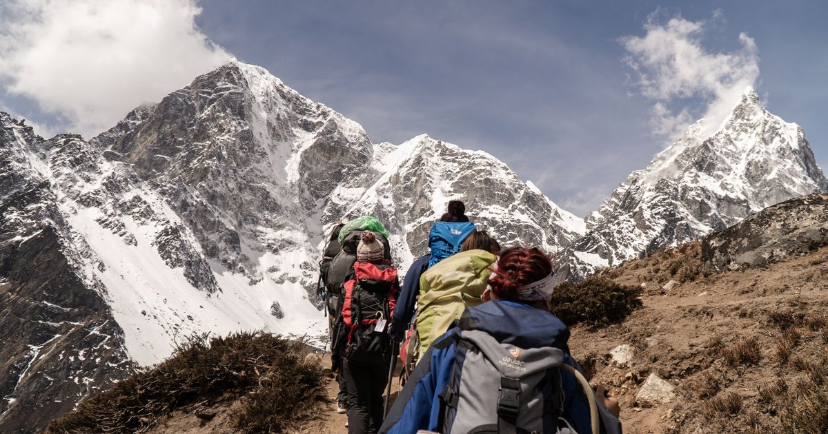
Because the circuit spans so many altitudes and cultures, your kit has to cover everything from warm afternoons to sub-zero mornings. A layered clothing system, genuine cold-weather gear for the pass, and broken-in boots do more for your trek than anything else you carry.
Difficulty, Distance and How Hard It Really Is
The Annapurna Circuit is graded moderate to strenuous. It is not a technical mountaineering objective, and thousands of ordinary walkers complete it every season. The difficulty comes from three things: the total distance, the daily elevation gain, and the sustained time at altitude.
Daily walking usually runs five to seven hours, longer on the pass day. The trail surface is mostly good, with stone steps, dirt paths and some rocky sections higher up. If you can walk for several hours a day, several days in a row, on hills, you have the baseline fitness. Preparation in the months before, especially hill walking with a loaded pack, pays off more than gym sessions.
The honest limiter is altitude, not stamina. Above 4,000 meters the air thins enough that everyone slows down, and how your body responds to that is not something training can fully control. This is why the itinerary above builds in a rest day and keeps the sleeping-altitude gains modest.
Your Acclimatization Plan and Altitude Safety
Altitude sickness is the single most important risk on the circuit, and the good news is that a sensible itinerary prevents most of it. The US Centers for Disease Control notes that altitude illness can begin at sleeping altitudes at or above 2,450 meters, and that among visitors sleeping above that level in Colorado, around 25 percent develop acute mountain sickness, per the CDC Yellow Book on high-altitude travel. On the circuit you sleep far higher than that for days at a time, so the margin for careless ascent is thin.
The CDC's core guidance maps neatly onto a well-built itinerary:
- Limit how fast you sleep higher. Above 3,000 meters, the CDC advises increasing sleeping altitude by no more than about 500 meters per night, and adding an extra acclimatization day for every 1,000 meters gained. The Manang rest day and the gentle steps to Yak Kharka and Phedi exist for exactly this reason.
- Know the early symptoms. Headache, nausea, poor sleep and loss of appetite are the common warning signs. They usually mean you have climbed too fast, not that you are unfit.
- Descend if symptoms worsen. The reliable cure for altitude illness is going down. Any itinerary that does not allow for a descent day is one to question.
- Hydrate and don't rush. Drink steadily, walk at a conversational pace, and let the slow days do their work.
A responsible operator plans the schedule around these thresholds rather than around a tight calendar. If a proposed itinerary crosses Thorong La with only a couple of nights above 3,000 meters beforehand, that is a warning sign worth raising before you commit.
Permits, Costs and the Paperwork You Need
The circuit sits inside the Annapurna Conservation Area, Nepal's largest protected area, so you need an ACAP entry permit to trek it. Most trekkers also carry a TIMS card, the Trekkers' Information Management System registration used across Nepal's trekking regions, though the rules on when it is required have shifted in recent years and enforcement varies by season.
Because permit fees and requirements change from year to year, and because Nepal has moved toward requiring licensed guides in many trekking areas, the safest approach is to confirm the current rules when you book rather than relying on last year's figures. A guided operator handles these permits for you as part of the package, which removes a real logistical headache in Kathmandu or Pokhara.
Beyond permits, budget for guide and porter fees, teahouse accommodation and meals along the trail, and transport in and out. Costs rise with altitude, since everything on the upper trail is carried or flown in. Booking through a single operator bundles most of this into one price, which makes comparing trips easier than assembling the pieces yourself.
Getting There, Teahouses and Money on the Trail
The trek proper begins with a road journey from Kathmandu or Pokhara to the trailhead. From Kathmandu, expect a long day by private jeep up the Marsyangdi valley to Chame or beyond. Many trips instead start from Pokhara, which is closer to the Annapurna region and a common finishing point too. Pokhara is a relaxed lakeside town and a natural place to spend a night either side of the trek.
Accommodation on the circuit is in teahouses, family-run lodges that offer a simple room and a shared dining hall. Rooms are basic, usually twin beds with thin walls, and the dining room with its central stove is where trekkers gather in the evening. Menus are broad lower down and shrink as you climb, but you can count on dal bhat, the Nepali rice-and-lentil staple that comes with free refills and is genuinely the best fuel for a long walking day.
A few practical notes that first-timers often miss:
- Carry cash. There are no reliable ATMs once you leave the larger towns. Draw enough Nepali rupees in Kathmandu or Pokhara to cover meals, drinks, charging and hot showers for the whole trek, with a buffer.
- Prices rise with altitude. A bottle of water or a meal costs noticeably more at Thorong Phedi than in Chame, because everything is carried up by porter or mule.
- Charging and Wi-Fi cost extra. Most teahouses charge a small fee to charge a phone or use the network. A power bank saves money and hassle.
- Water is a daily decision. Buying bottled water adds up and creates plastic waste. A filter bottle or purification tablets let you refill from teahouse taps and streams, which is cheaper and kinder to the trail.
The Tilicho Lake Side Trip
If your schedule has room, the detour to Tilicho Lake is the circuit's finest add-on. Tilicho sits at roughly 4,900 meters and ranks among the highest lakes of its size in the world. The turquoise water framed by ice makes it one of the most photographed spots in the whole region.
The side trip branches off near Manang and adds two to three days. The walk to Tilicho Base Camp crosses a notorious landslide-prone slope that demands an early start and careful footing, especially in the afternoon when rockfall is more likely. From base camp, the pre-dawn climb to the lake and back is long and cold, at an altitude where the thin air makes every step deliberate.
The reward beyond the view is acclimatization. Sleeping higher near Tilicho, then dropping back to rejoin the main trail, primes your body well for Thorong La. The trade-off is the extra days and the exposure on the landslide section, which closes in poor weather. It is a side trip best done with a guide who knows the current conditions and can turn you around if the slope is unsafe.
Best Trekking Seasons for the Annapurna Circuit
Two windows stand out, and one is worth planning around if you can.
Autumn, October to November, is the most reliable season. The monsoon has cleared the air, the skies are stable, and the mountain views are at their sharpest. It is also the busiest window, so the pass and popular teahouses fill up. Booking ahead matters more here.
Spring, March to May, is the second-best choice. Temperatures are milder lower down, and the rhododendron forests bloom across the foothills. Higher haze can build later in spring, but the weather is generally settled.
Summer, June to August, brings the monsoon, with rain, leeches, landslide risk and cloud that hides the peaks. The rain shadow beyond Manang stays drier, so some experienced trekkers still go, but it is not a first-timer's season. Winter, December to February, is cold and clear at lower elevations, but heavy snow can close Thorong La entirely.
Whichever window you pick, book early for the autumn peak, when guides, teahouse beds and domestic flights out of Jomsom all fill quickly.
Common Mistakes to Avoid
A few errors show up again and again on the circuit, and all of them are avoidable.
- Climbing too fast to save days. Skipping the Manang rest day to shorten the trip is the most common cause of altitude trouble. The days you save are not worth the risk.
- Underestimating the cold on the pass. People pack for the warm valleys and get caught out at 5,416 meters before dawn. Bring genuine cold-weather layers.
- Booking the tightest possible itinerary. A schedule with no spare day leaves no room for weather delays or a slow acclimatizer. Build in flexibility.
- Carrying too much. A heavy pack turns every uphill into a grind. Pack deliberately, and consider a porter for the high sections.
- Ignoring early symptoms. A headache brushed off at Yak Kharka can become a serious problem at High Camp. Say something early.
Booking the Annapurna Circuit With Mission Nepal Holidays
If you have decided the circuit is your trip, the next step is choosing how you want it supported. Mission Nepal Holidays runs guided Annapurna Circuit itineraries built around the acclimatization thresholds above, with licensed multilingual guides who make the altitude and weather calls so you don't have to. That covers the parts most first-timers find hardest to judge alone: how fast to climb, when to rest, and when to turn around.
A supported trip also folds the logistics into one plan. Permits, teahouse bookings, jeep transfers on the lower road sections, and the flight or drive out from Jomsom are arranged for you, so your days on the trail stay focused on the walking. If you are weighing the circuit against other options, our roundup of the best Nepal trekking tours puts it alongside the country's other classic routes.
The Annapurna Circuit rewards preparation and patience more than anything else, and a well-planned itinerary is most of that battle. When you are ready to set dates, reach out to Mission Nepal Holidays to build a schedule that gives your body the time it needs and puts you on Thorong La with room to enjoy it.
Frequently asked questions
How long does the Annapurna Circuit take?
Most guided itineraries run 12 to 18 days on the trail, plus travel days at each end. Shorter versions use jeep transport to skip the lower road sections, while a fully walked classic route takes longer.
How high is Thorong La pass?
Thorong La sits at 5,416 meters (17,769 feet). It is the highest point of the circuit and the reason acclimatization matters so much.
Do I need a guide for the Annapurna Circuit?
Nepal now requires a licensed guide for most trekkers in national parks and conservation areas. A guide also manages permits, teahouse bookings and altitude decisions, which is where a supported trip earns its keep.
What is the best time to trek the Annapurna Circuit?
October and November offer the most reliable weather and views. March to May is the second-best window. Avoid the June to August monsoon, when landslides and cloud are common.