
The Country of Nepal: Geography, Culture & Travel
Activities Highlights
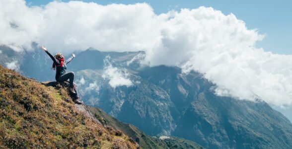
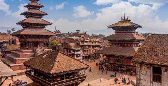
Key takeaways
- The country of Nepal is a landlocked nation between India and Tibet, home to 8 of the world's 14 peaks above 8,000 meters.
- Nepal's land rises from lowland Terai plains near sea level to the summit of Mount Everest in a short north-to-south span.
- The country is strikingly diverse, with well over a hundred caste and ethnic groups and more than a hundred languages spoken as mother tongues.
- Nepal holds four UNESCO World Heritage Sites, including Lumbini, the birthplace of the Buddha.
- October to November and March to May are generally the most reliable windows for trekking and clear mountain views.
The country of Nepal is a landlocked nation in South Asia, wedged between India and the Tibet Autonomous Region of China, and it holds eight of the fourteen highest mountains on Earth. If you are trying to picture where it sits and what it actually contains, the short answer is a narrow country, only about 150 to 250 kilometers wide north to south, that climbs from steamy lowland jungle to the summit of Everest in that short distance.
This guide covers what that geography means on the ground: where Nepal is, who lives there, the languages and faiths that shape daily life, the regions worth your time, the climate you will meet at each elevation, and how to plan a first visit without overreaching. The aim is to give you a clear map of the country before you commit to a route or a season.
Where the Country of Nepal Sits on the Map
Nepal is a compact country, landlocked on all sides, with India bordering it to the south, east, and west, and China's Tibet to the north. There is no coastline anywhere, and the nearest sea access runs through India.
The shape matters more than the total area. Nepal is long and thin, stretching about 880 kilometers from east to west but only 150 to 250 kilometers from the Indian plains up to the Tibetan border. That compression is why the country changes so dramatically over a short drive or flight. You can start a morning in subtropical heat and, within a day, stand among glaciers.
The border with China follows the crest of the Himalaya for long stretches, which is why Everest and several other giants are shared summits. The southern edge dissolves into the flat, fertile Gangetic plain that Nepal shares culturally and agriculturally with northern India.
The Himalayan Backbone
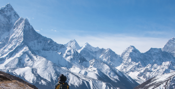
The defining feature of the country is the Himalaya, and Nepal carries a disproportionate share of the range's highest ground. Eight of the world's fourteen peaks above 8,000 meters lie in or along Nepal's borders, as tracked by mountaineering outlets such as ExplorersWeb: Everest, Kanchenjunga, Lhotse, Makalu, Cho Oyu, Dhaulagiri, Manaslu, and Annapurna I.
Mount Everest, called Sagarmatha in Nepali and Chomolungma in Tibetan, is the highest of them, standing just under 8,850 meters after the 2020 joint survey by Nepal and China. It sits on the northern border, and its Nepal-side approach through the Khumbu is the one most trekkers know.
These are not the only mountains that matter. The Annapurna massif in central Nepal, the Langtang range close to Kathmandu, and Manaslu all draw serious trekkers, and each has its own character. Patience matters more than raw fitness on any of them, because altitude sets the pace regardless of how strong you are.
People, Ethnic Groups, and Languages
Nepal is far more diverse than its size suggests. The most recent national census counted well over a hundred distinct caste and ethnic groups, a number that has grown as more communities are formally recognized. That diversity reflects both hill and plains communities, from Sherpa and Tamang in the high country to Tharu in the Terai and Newar in the Kathmandu Valley.
Language follows the same pattern. More than a hundred languages are spoken as mother tongues across the country, with Nepali serving as the national language and lingua franca. In tourist areas and among guides, English is widely understood, so you can travel and trek comfortably without any Nepali, though a few polite words go a long way.
This diversity shows up in daily life. It shapes the food you eat in different valleys, the festivals you may stumble into, and the architecture of each town. A Newar settlement in the Kathmandu Valley looks and feels different from a Sherpa village in the Khumbu or a Tharu community near Chitwan.
Religion and Sacred Landscapes
Hinduism and Buddhism define the spiritual life of the country, and they overlap constantly. A large majority of the population identifies as Hindu, with Buddhists forming the next largest group and Islam, Kirat, and Christianity making up most of the remainder.
The practical effect for a visitor is that shrines blur the line between the two faiths. Pilgrims of both traditions visit the same temples, and many rituals borrow freely across them. Lumbini, in the southern Terai, is recognized by UNESCO as the birthplace of the Buddha, which makes Nepal a destination for Buddhist pilgrims as well as trekkers.
For Hindu and Buddhist pilgrims alike, the sacred geography extends beyond Nepal's borders into Tibet, where Mount Kailash is revered by four faiths. Many pilgrims combine time in Nepal with the journey to Kailash, treating the two as parts of a single spiritual route.
Food, Festivals, and Everyday Culture
What you eat in Nepal changes with the terrain, but one plate follows you everywhere: dal bhat, a set of lentil soup, rice, curried vegetables, and pickles, usually with free refills. Trekkers rely on it because it is filling, freshly cooked, and available in almost every teahouse. In the Kathmandu Valley, Newari cuisine adds its own range, from momos (steamed dumplings) to spiced meat dishes eaten during festivals.
Festivals structure the calendar and are worth planning around. Dashain, the longest and most important, falls in autumn and empties city streets as families travel home. Tihar, the festival of lights, follows soon after, with homes and shops strung with lamps and marigolds. In the mountains, Tibetan Buddhist communities mark Losar, the lunar new year, with masked dances at monasteries.
For a visitor, festivals are both an opportunity and a logistical wrinkle. Timing a trip around Dashain or Tihar means witnessing the country at its most vivid, but it also means booked buses, closed offices, and higher demand for guides. If your dates overlap a major festival, arrange transport and permits well ahead.
The Three Great Regions
Nepal divides neatly into three belts that run east to west, and understanding them helps you place any trip.
- The Terai is the southern lowland strip, an extension of the Indian plains. It holds much of the country's farmland, its warmest weather, and its wildlife parks, including Chitwan. This is where you go for jungle safaris, rhinos, and, occasionally, tigers.
- The Hills form the broad middle belt, roughly 600 to 3,000 meters. Kathmandu and Pokhara both sit here. Most of the population lives in this zone, terraced across ridges and river valleys, and it is where culture and trekking often meet.
- The Mountains are the high northern belt along the Tibetan border, home to the 8,000-meter peaks and the classic high-altitude treks. Villages here are sparse, seasonal, and shaped by Tibetan Buddhist culture.
Each belt has its own rhythm. A well-planned trip often samples two of them, pairing a cultural or wildlife stay in the Terai or Hills with time in the mountains.
Kathmandu, Pokhara, and the Cultural Core
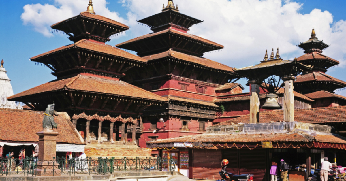
The Kathmandu Valley is the cultural heart of the country and one of Nepal's four UNESCO World Heritage Sites, as listed by UNESCO. The valley alone contains seven monument zones, including the Durbar Squares of Kathmandu, Patan, and Bhaktapur, plus Pashupatinath, Boudhanath, and Swayambhunath.
Most visitors spend their first and last days here, sorting permits, gear, and jet lag while wandering temple courtyards and market lanes. The valley works well as a base for short cultural day trips before and after a trek.
Pokhara, a few hours west, is the gateway to the Annapurna region and a calmer base than the capital. It sits beside a lake with the Annapurna range rising behind it, and it is the usual starting or finishing point for treks like the Annapurna Circuit and the shorter Ghorepani Poon Hill loop.
Wildlife and the Lowland Parks
The mountains get the attention, but the Terai holds some of Nepal's richest wildlife. Chitwan National Park, a UNESCO-listed protected area, shelters greater one-horned rhinos, Bengal tigers, gharial crocodiles, and hundreds of bird species across its grasslands and sal forests. Bardia National Park, farther west and less visited, offers a quieter chance at tigers and wild elephants.
A typical lowland stay runs two or three nights, with dawn and dusk safaris on foot, by jeep, or by canoe on the Rapti River. Rhino sightings are common in Chitwan; tigers are elusive and far from guaranteed, so treat any encounter as luck rather than an itinerary item.
This lowland option matters for trip design. If a companion cannot or does not want to trek at altitude, a few days in Chitwan or Bardia gives them a full Nepal experience at a gentle elevation while others take on the hills. It also pairs naturally with Lumbini, which sits in the same southern belt.
Climate Zones from Jungle to Ice
Because Nepal rises from lowland plains only a few dozen meters above sea level to the summit of Everest, it packs several climate zones into a small footprint. The practical result is that no single description of "Nepal weather" holds true everywhere at once.
Broadly, expect this pattern:
- Terai (below 300m): subtropical, hot, and humid, with monsoon rains from roughly June to September.
- Hills (300 to 3,000m): temperate and comfortable for much of the year, with warm days and cool nights at the upper end.
- High mountains (above 3,000m): cold, thin air, and heavy snow in winter, with a short, stable window in spring and autumn.
Altitude, not the calendar alone, governs what you wear and how you feel. You can trek from rice paddies to rhododendron forest to alpine desert in a single route, changing layers every few days.
Why Trekkers and Pilgrims Keep Coming
The country draws two overlapping crowds: people chasing high mountains and people chasing sacred ground. Foreign arrivals reached 1,147,567 in 2024, a 13 percent rise over the previous year, according to Rising Nepal Daily citing Nepal Tourism Board data. That recovery brought numbers close to pre-pandemic levels.
Trekkers come for the obvious reason: nowhere else offers this density of accessible high peaks with a network of teahouses that let you walk for days without carrying a tent. The Everest Base Camp and Annapurna routes are the best known, but Langtang, Manaslu, and the Gokyo Lakes reward those who want thinner crowds.
Each route has a distinct personality. Everest Base Camp is a there-and-back walk through Sherpa country to the foot of the world's highest peak, with big elevation and famous scenery. The Annapurna Circuit loops through changing landscapes and crosses a high pass, showing more variety of climate and culture in one trip. Langtang, close to Kathmandu, is shorter and often chosen when time is tight. Manaslu and the Three Passes route reward experienced trekkers who want fewer crowds and more commitment.
Pilgrims come for Lumbini, Pashupatinath, Muktinath, and the onward journey to Kailash in Tibet. Muktinath in particular sits high in the Annapurna region and draws both Hindu and Buddhist devotees, so a single trek can hold both scenery and sacred meaning. For many, the trip is as much an inner one as a physical one, and the two motivations often travel together on the same trail.
Permits, Timing, and Getting Around
Trekking in Nepal is regulated, and the rules exist to keep visitors traceable in the mountains. Most treks require a TIMS card and a permit for the relevant conservation area or national park, and restricted regions like Manaslu and Upper Mustang need a licensed guide and a special permit. Requirements change, so confirm the current list for your specific route when you book rather than relying on an old blog.
On timing, autumn (October to November) and spring (March to May) are generally the most reliable windows for clear views and stable trails. Winter suits lower routes if you can handle the cold, and the summer monsoon soaks most of the country except the rain-shadow areas like Mustang and Dolpo. It is worth weighing the trade-offs of each window against your priorities for views, crowds, and cost.
Getting around means a mix of short domestic flights, long road journeys, and walking. Roads are slow and winding in the hills, so allow buffer days. Flights to mountain airstrips like Lukla depend on weather and can be delayed, which is another reason to build slack into any itinerary.
Altitude, Health, and Staying Safe
Altitude is the single biggest health factor in the Nepal mountains, and it deserves respect regardless of your fitness. Above roughly 2,500 meters, the thinner air can bring on acute mountain sickness, with symptoms like headache, nausea, and poor sleep. The reliable defense is a slow ascent, extra fluids, and a willingness to stop or descend if symptoms worsen. Fit young trekkers are not immune; the body acclimatizes on its own schedule.
A few concrete habits reduce the risk:
- Follow the climb-high, sleep-low principle on acclimatization days, walking up a few hundred meters and returning lower to sleep.
- Cap your net daily gain in sleeping altitude to a modest amount once above 3,000 meters, and build in rest days.
- Carry travel insurance that covers helicopter evacuation. In remote regions this is the only fast way down, and it is expensive without cover.
- Know the descent trigger. If symptoms do not ease with rest, going down even a few hundred meters usually resolves them.
Beyond altitude, the ordinary risks are stomach upsets and cold. Drink treated or bottled water, eat freshly cooked food, and pack a basic kit for blisters and mild illness. Mobile coverage reaches many trails now, but do not count on it in remote valleys, so agree on a plan with your guide.
Planning Your First Trip
A sensible first visit to Nepal usually follows a simple arc. Arrive in Kathmandu, spend a day or two adjusting and seeing the valley, then travel to your trek's starting point, walk for anywhere from 5 to 20 days depending on the route, and return with a buffer day before your flight home.
A few practical decisions shape everything else:
- Pick a realistic route. For a first trek, Ghorepani Poon Hill, Langtang, or a shorter Everest-region option is more forgiving than a full high pass. Ambition is fine, but altitude does not negotiate.
- Build in acclimatization. Ascend gradually and include rest days above 3,000 meters. This single habit prevents most altitude problems.
- Pack in layers. You will cross several climate zones, so a system you can add to and shed matters more than any single heavy jacket. A good base layer, an insulating mid layer, and a waterproof shell cover most conditions.
- Decide guided or independent early. A licensed guide handles permits, logistics, and safety calls, which matters most on remote or restricted routes.
On entry, most nationalities can obtain a tourist visa on arrival at Kathmandu's airport, with 15, 30, and 90-day options, though rules shift, so check your own country's status before you fly. Bring passport photos and the fee in cash to smooth the process. Trekking permits are separate from the visa and are arranged in Kathmandu or Pokhara, either directly or through your operator.
For a first trip, a two-week frame works well. A realistic shape might look like this:
- Days 1 to 2: Arrive in Kathmandu, rest, and see the valley's temples and squares.
- Days 3 to 4: Travel to your trailhead, by flight to Lukla for Everest routes or by road to Pokhara for Annapurna.
- Days 5 to 12: Trek, with acclimatization and rest days built into the higher sections.
- Days 13 to 14: Return to Kathmandu with a buffer day to absorb any flight delays before flying home.
Budgets vary widely with your style. Teahouse trekking with a guide is far cheaper than a fully catered expedition, and prices rise with altitude as everything must be carried or flown in. Carry some cash, since ATMs thin out quickly once you leave the towns.
Mission Nepal Holidays runs guided treks, cultural tours, and pilgrimage journeys across Nepal, Tibet, and Bhutan, with multilingual guides who manage the permits and daily logistics so you can focus on the walking. That support tends to matter most for first-timers and for anyone attempting a restricted route where a guide is mandatory anyway.
Bringing It Together
The country of Nepal rewards travelers who match their ambitions to its terrain and its seasons. Whether you are drawn by the mountains, the temples, or both, the smart first move is to choose a route that fits your fitness and your calendar, then build the acclimatization and buffer days around it.
If you are ready to turn this into a plan, start by picking a target region and season, then talk through a realistic itinerary with Mission Nepal Holidays before you lock in flights.
Frequently asked questions
Where is the country of Nepal located?
Nepal is a landlocked country in South Asia, sitting between India to the south, east, and west and China's Tibet Autonomous Region to the north. It runs roughly 880 kilometers east to west along the central Himalaya.
What is the main religion in Nepal?
Hinduism is the largest religion and Buddhism the next largest, with a smaller share following Islam, Kirat, and Christianity. In daily life the two main traditions blend closely at many temples and festivals.
How many mountains over 8,000 meters are in Nepal?
Eight of the world's 14 mountains above 8,000 meters lie in or on Nepal's borders, including Everest, Kanchenjunga, Lhotse, Makalu, Cho Oyu, Dhaulagiri, Manaslu, and Annapurna I.
When is the best time to visit Nepal?
Autumn (October to November) and spring (March to May) generally offer the clearest skies and most stable trekking conditions. Winter is cold at altitude but fine for lower routes, and the summer monsoon brings heavy rain to much of the country.