
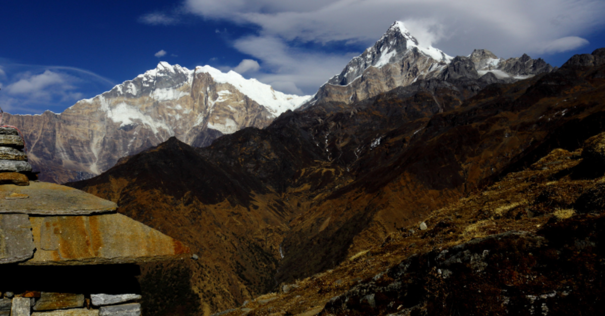
Manaslu Circuit Trek: Remote Himalaya Itinerary
Activities Highlights
Key takeaways
- The Manaslu Circuit runs roughly 177 km around the world's eighth-highest mountain and takes most trekkers 12 to 14 days on the trail.
- Manaslu is a restricted area, so you must trek through a registered Nepali agency with a licensed guide and carry a Restricted Area Permit.
- The Restricted Area Permit costs USD 100 per week in peak season (September to November) and USD 75 per week the rest of the year.
- Larkya La, the trek's high point at about 5,106 meters, is the hardest single day and the main reason acclimatization planning matters.
- Spring (March to May) and autumn (September to November) give the clearest, safest conditions for the crossing.
If you are weighing the Manaslu Circuit Trek against better-known routes, here is the short answer: it gives you high Himalayan scenery and a serious pass crossing with a fraction of the crowds you would meet on Everest or Annapurna. The trade-off is that Manaslu is a restricted area, so you trek with a licensed guide through a registered agency, and you plan around that from the start.
This guide walks through what the circuit actually involves: why trekkers are turning to it, the day-by-day route and the Larkya La pass, the permits and special rules, the landscapes and culture you pass through, how hard it really is, and how a guided trip is usually put together. The aim is to help you decide whether this is your next trek, and to plan it properly if it is.
Why Manaslu Is Nepal's Rising Trekking Star
Manaslu is the eighth-highest mountain in the world at 8,163 meters, according to Wikipedia's Manaslu entry. The circuit loops around its base through the Budhi Gandaki valley, climbing from subtropical foothills to a high glacial pass and back down into the Annapurna region. That range of terrain, packed into roughly two weeks, is a large part of the appeal.
The quieter part is just as important. Because the region sits close to the Tibetan border and carries restricted-area status, foot traffic stays far lower than on Nepal's flagship routes. You will not find the long teahouse lines or the busy lodges of the Annapurna thoroughfare. The trail feels remote in a way that older trekkers remember from Nepal decades ago.
Infrastructure has caught up enough to make the trek comfortable without erasing that feel. Teahouses now run the length of the circuit, so you sleep and eat in villages rather than camping, yet the lodges stay simple and small. For trekkers who want a genuine high-mountain journey rather than a scenic stroll, Manaslu hits a rare balance. It is demanding enough to feel earned and accessible enough that a fit first-timer can finish it with the right support.
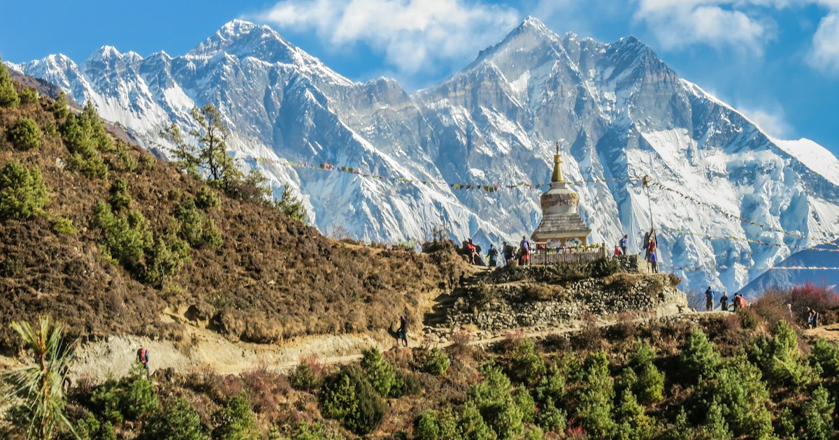
Many trekkers who have already done Everest Base Camp or the Annapurna Circuit come to Manaslu next, looking for the same scale with more solitude. It is one of the Himalayan bucket-list routes that consistently surprises people who thought they had already seen Nepal's best trails.
Day-by-Day Route and the Larkya La Pass
The standard circuit covers roughly 177 kilometers and takes most trekkers 12 to 14 days on the trail, with 15 to 18 days total once you add travel from Kathmandu and acclimatization. Exact duration varies by operator and by how many extra rest days you build in, so confirm the day count when you book. Here is a typical shape for the itinerary.
The approach: Soti Khola to Namrung
The trek usually starts with a long drive from Kathmandu to Soti Khola or Machha Khola, the roadhead at the foot of the valley. The first few days follow the Budhi Gandaki river upstream, crossing suspension bridges and climbing through rice terraces, waterfalls, and subtropical forest.
- Day 1: Soti Khola to Machha Khola. A warm, low walk along the river, roughly six hours.
- Day 2: Machha Khola to Jagat. Hot springs at Tatopani, then the official restricted-area checkpoint at Jagat where permits are inspected.
- Day 3: Jagat to Deng. The valley narrows and the first Tibetan-influenced villages appear.
- Day 4: Deng to Namrung. You cross into visibly Buddhist country, with mani walls, prayer flags, and your first clear high-peak views.
The high valleys: Namrung to Samagaon
From Namrung the trail climbs into the upper valley, where the culture turns strongly Tibetan and the scenery opens to glaciers and 7,000-meter peaks.
- Day 5: Namrung to Lho. Manaslu itself comes into full view above the village.
- Day 6: Lho to Samagaon. A short day by design, ending in the largest village on the route at about 3,500 meters.
- Day 7: Acclimatization day at Samagaon. A rest day with an optional hike to Manaslu Base Camp or the glacial Birendra Lake. This day is not optional in spirit; it is the acclimatization that keeps the pass safe.
The crossing: Samdo, Dharamsala, and Larkya La
The last stretch before the pass is where the altitude becomes the main character.
- Day 8: Samagaon to Samdo. The last permanent village, a Tibetan trading settlement near the border.
- Day 9: Samdo to Dharamsala (Larke Phedi). A short, deliberately easy walk to the high camp at roughly 4,460 meters, resting the legs for the big day.
- Day 10: Dharamsala to Bimthang over Larkya La. The crossing. You start in the dark, climb slowly to the pass at about 5,106 meters per Wikipedia's Larkya La entry, then make a long descent to Bimthang. Expect six to nine hours of walking, sometimes more in snow.
Larkya La is the physical and emotional high point of the trek. The views across the Annapurna and Manaslu ranges from the top are the reason many people come. It is also the one day that demands genuine respect: an early start, steady pacing, and a willingness to turn back if weather closes in.
The descent: Bimthang to Dharapani
After the pass the trail drops fast through pine forest and pasture into the Annapurna region, finishing at Dharapani where you meet the Annapurna Circuit road. From there a jeep takes you toward Besisahar and back to Kathmandu. The descent days are easier on the lungs but long on the knees, so trekking poles earn their keep here.
Restricted-Area Permits and Special Rules
Manaslu's paperwork is different from a standard trek, and understanding it early saves trouble. The region is a designated restricted area, which means you cannot trek it independently in the way you can walk much of Annapurna or Everest.
The three permits you need
- Restricted Area Permit (RAP). This is the core document. It costs USD 100 per person per week during the peak season of September to November, and USD 75 per person per week the rest of the year, according to the Nepal Tourism Board's official park and permit fees. Beyond the first week you pay a daily add-on. The RAP is issued only through a registered agency; you cannot buy it yourself at a counter.
- Manaslu Conservation Area Project (MCAP) permit. NPR 3,000 per foreign trekker, per the same Nepal Tourism Board source, covering the conservation area you spend most of the trek inside.
- Annapurna Conservation Area Project (ACAP) permit. Also NPR 3,000 per foreign trekker. You need this because the final descent crosses into the Annapurna region.
Carry printed copies and your passport throughout. Checkposts at Jagat, Samagaon, and Dharapani inspect permits, and guides handle most of this for you.
The guide and agency rule
Because of the restricted-area status, you must book through a registered Nepali trekking agency and trek with a licensed guide. The guide requirement is a legal condition for entering the area, and it is the main reason a Manaslu trip is structured differently from a self-arranged Annapurna walk. The permit application itself runs through the agency, which lodges it with the Department of Immigration in Kathmandu before you set off.
Rules in restricted regions do get revised from time to time, including group-size and solo-trekker conditions, so treat the agency requirement as fixed and confirm the current fine print when you book. A reputable agency tracks these changes for you and applies for the correct permits under current rules, which is one reason independent planning is not an option here.
Landscapes, Culture, and Quiet Trails
What sets Manaslu apart on the ground is the sheer variation packed into a single loop. In the lower valley you walk through humid forest, past waterfalls and terraced fields, with monkeys in the trees and the river roaring below. Within a few days you are among stone villages, barley fields, and yak pastures, with glaciers hanging off peaks that top 7,000 meters.
The cultural shift is just as striking. The upper Manaslu valley, sometimes called Nubri and Tsum country, is strongly Tibetan Buddhist. You pass long mani walls carved with prayers, spinning prayer wheels, chortens, and small gompas where monks still study. Villages like Lho and Samagaon feel closer to Tibet than to Kathmandu in architecture, dress, and daily rhythm.
Simple etiquette that matters here
- Walk clockwise around mani walls and chortens. Keep these sacred structures on your right, as local custom holds.
- Ask before photographing people, monks, or interiors. A smile and a gesture are usually enough; a refusal should be respected.
- Dress modestly in villages and monasteries. Covered shoulders and knees show basic respect.
- Buy local where you can. Tea, meals, and handicrafts in the villages keep money in the valley.
The quiet is the thing most trekkers remember. On many stretches you walk for hours seeing only a handful of other people. That solitude is fragile, which is part of why the restricted-area rules exist, and why traveling responsibly matters. The Tibetan Buddhist thread of this trek runs deep, connecting Manaslu to the wider sacred geography of the high Himalaya and the pilgrimage traditions that shaped these valleys long before trekkers arrived.
Difficulty and Acclimatization Planning
Manaslu is a strenuous trek, but not a technical one. You do not need ropes, crampons for most of the year, or mountaineering experience. What you need is endurance for long walking days, often six to nine hours, and a body that adapts well to altitude. Patience matters more than athletic ability here.
Where the difficulty really lives
The hard part is the altitude, concentrated around Larkya La. Climbing to 5,106 meters and spending several nights above 3,500 meters puts real demand on your body. Altitude sickness does not care how fit you are; a marathon runner who climbs too fast is at more risk than a slower trekker who acclimatizes properly.
The second challenge is the terrain itself. The pass day is long and the descent to Bimthang is steep. Early in the season, snow on the pass can turn a hard day into a very hard one, which is another reason to trek in the stable windows.
Acclimatization basics that keep you safe
- Build in the Samagaon rest day. Do not skip it to save time. An active rest day, climbing high and sleeping low, is the single best defense against altitude sickness.
- Keep the pre-pass days short. The deliberately easy walk from Samdo to Dharamsala exists so you reach the high camp with energy in reserve.
- Walk slowly and drink more than feels necessary. A steady, unhurried pace is the trekking cliche that actually works.
- Know the warning signs. Headache, nausea, dizziness, and poor sleep are early flags. Tell your guide immediately; descending is the cure, and your guide is trained to make that call.
A good guide watches the whole group for these signs, which is one of the quiet benefits of the mandatory-guide rule. The same acclimatization logic applies on comparably high routes like Everest Base Camp, where the climb to 5,000-plus meters rewards slow, patient trekkers over fast ones every time.
Choosing your season
Spring, March to May, brings rhododendron blooms lower down and generally stable weather higher up. Autumn, September to November, is the classic post-monsoon window with the clearest skies, and it is also the busiest and the priciest for permits. Winter crossings of Larkya La are possible but cold and snow-prone, and the monsoon months bring leeches, cloud, and landslide risk in the lower valley. For most trekkers, the two shoulder-free windows are the sensible choice, as the Nepal Tourism Board confirms for this region.
What Fitness and Preparation Look Like
You do not need to be an athlete, but you do need to arrive prepared. Build toward being able to walk uphill for several hours carrying a daypack, several days in a row. Hill walking, stair climbing, and long weekend hikes in the months before your trip do more than gym cardio alone.
Pack for a genuine range of temperatures: warm valleys at the start, freezing pre-dawn conditions on the pass, and everything between. A properly broken-in pair of boots prevents the blisters that end more treks than altitude does. Trekking poles help enormously on the long Bimthang descent. A sleeping bag rated to around minus 10 Celsius, a down jacket, and reliable layers earn their place in your bag; the teahouses provide blankets, but nights near the pass are genuinely cold.
Two practical points trekkers often underestimate: insurance and buffer days. Make sure your travel insurance explicitly covers trekking to 5,500 meters and helicopter evacuation, because standard policies frequently do not. And build a spare day or two into your schedule, since weather on Larkya La can force a wait at the high camp.
Food, Lodging, and Connectivity on the Trail
Teahouse lodges line the whole circuit now, so you sleep indoors and eat cooked meals every night. Rooms are basic, usually twin beds with shared bathrooms, and get simpler as you climb. The staple meal is dal bhat, a refillable plate of rice, lentils, and vegetables that fuels most trekking days well. Higher up, the menu narrows and prices rise, since everything is carried in by porter or mule.
Hot showers, charging, and Wi-Fi are often available for a small fee in the lower and middle villages, and they thin out near the pass. Mobile signal is patchy throughout and absent in places, so tell people at home not to expect daily contact. Carry enough Nepali rupees in cash for the whole trek, as there are no ATMs once you leave the roadhead, and card payment is rare.
What a Trip Typically Costs
Manaslu trekking packages vary with season, group size, and inclusions, so treat any single figure as a starting point rather than a quote. The fixed government costs are the clearest part of the budget: the Restricted Area Permit at USD 100 per week in autumn or USD 75 per week otherwise, plus NPR 3,000 each for the Manaslu and Annapurna conservation permits. Beyond that, your cost covers the licensed guide, porters, teahouse accommodation and meals, ground transport to the trailhead and back from Dharapani, and agency logistics.
A few variables move the number. Larger groups usually lower the per-person price, because guide and transport costs spread across more trekkers. Adding the Tsum Valley side trip or extending into the Annapurna Circuit lengthens the trip and the bill. Private rooms, extra rest days, and a personal porter all cost more. When you compare quotes between operators, check what is bundled: a cheaper headline price often leaves out permits, insurance support, or transport that a fuller package includes. Ask for a line-by-line breakdown so you are comparing like for like.
Common Mistakes to Avoid
- Rushing the itinerary. Cutting the Samagaon rest day to save time is the most common and most dangerous error. Altitude does not negotiate.
- Underestimating the pass day. Larkya La is long and high. Starting late or treating it as an ordinary walking day leaves you crossing in afternoon wind and cloud.
- Skimping on insurance. A policy that does not cover high-altitude evacuation can turn a manageable problem into a crisis.
- Treating gear as optional. Unbroken boots, no poles, or a sleeping bag rated too warm all cause real misery on a trek with this temperature range.
- Going too light on cash. No ATMs means the money you carry at the roadhead is the money you have for two weeks.
Guided Manaslu Circuit Trips With Mission Nepal
Because Manaslu is a restricted area, a guided trip is the only legal way in, and the structure of a well-run trip does a lot of the heavy lifting for you. Mission Nepal Holidays arranges the full package: the Restricted Area Permit and conservation permits lodged with the Department of Immigration, a licensed guide who knows the valley and watches the group for altitude symptoms, porters, teahouse logistics, and the Kathmandu transfers at each end.
A typical Mission Nepal itinerary runs the classic Soti Khola to Dharapani circuit over about two weeks, with the Samagaon acclimatization day built in rather than treated as a bolt-on. Tailored versions can add the side trip into the Tsum Valley, extend into the Annapurna Circuit after the pass, or adjust the pace for older trekkers and families who want extra rest days. Multilingual guides mean the cultural context of the gompas and villages gets explained rather than simply passed.
The practical value of booking a complete trip is that the parts that trip up independent-minded trekkers, the permits, the agency requirement, the acclimatization scheduling, are handled by people who do this route every season. You arrive able to focus on the walking and the mountains.
Manaslu rewards trekkers who plan it properly and walk it patiently. If this remote circuit is the one you have been circling, the concrete next step is to pick your season, spring or autumn, and talk to Mission Nepal Holidays about locking in permits and a licensed guide well before you fly, since restricted-area paperwork takes time to arrange.
Frequently asked questions
Can a first-time trekker do the Manaslu Circuit?
Yes, if you are reasonably fit and follow a sensible acclimatization schedule. The route asks for patience and steady walking rather than technical skill, though the altitude on Larkya La makes it harder than a short teahouse trek.
Do I need a guide for the Manaslu Circuit?
Yes. Manaslu is a restricted area, so you must book through a registered Nepali trekking agency and trek with a licensed guide. The Restricted Area Permit is issued only through an agency.
How much do Manaslu permits cost?
The Restricted Area Permit is USD 100 per person per week from September to November and USD 75 per week in other months. You also pay the Manaslu and Annapurna conservation area fees, each NPR 3,000 for foreign trekkers.
What is the best time to trek the Manaslu Circuit?
March to May and September to November. These windows give stable weather, clearer mountain views, and the safest conditions for crossing Larkya La.
How high is Larkya La pass?
Larkya La sits at about 5,106 meters. It is the highest point of the trek and the single most demanding day of the itinerary.